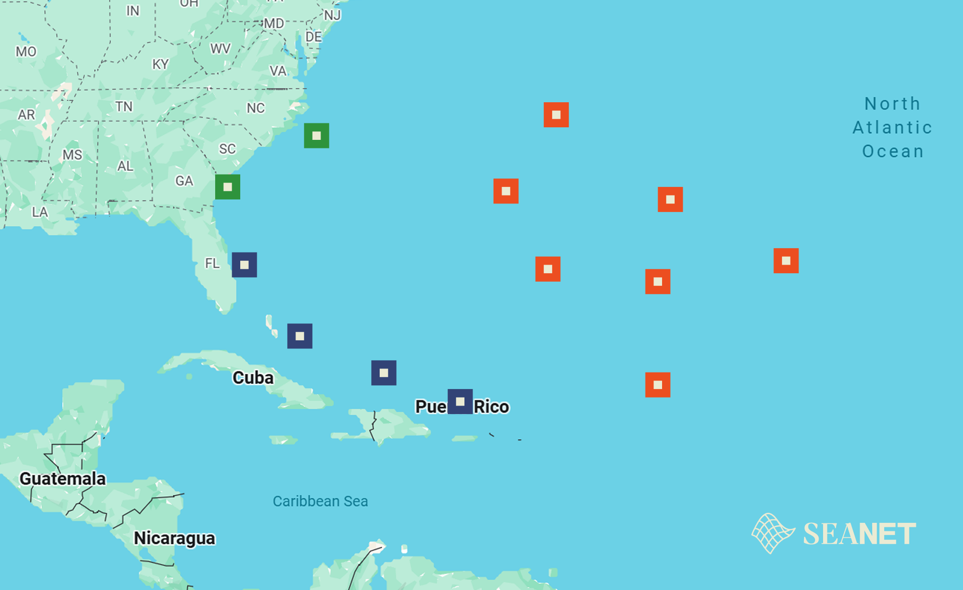
SeaNet is a powerful, scalable tool for tracking
marine plastic pollution. Its main functions are
to detect and locate macroplastics in near
real-time and to forecast their movement over
the coming days, much like a weather prediction
system. Results are displayed on an interactive
map similar to a meteoradar, allowing users to
quickly identify emerging plastic hotspots.
SeaNet doesn’t stop at local predictions—it
applies its models globally, creating a unified
forecast system. The platform also calculates
the surface area of plastic-affected zones,
giving stakeholders actionable insights for
planning clean-ups, assessing ecological risks,
and supporting evidence-based decision-making.
Technology Behind SeaNet
SeaNet combines Blue-Cloud’s Marine
Environmental Indicators VLab (VLab 2) with the
Virtual Research Environment (VRE) to run
particle-drift models seeded by detections.
Using Sentinel-2 Level-2A satellite
imageryprocessed in Google Earth Engine, the
system applies masks and calculates indices such
as FDI, NDPI, and NDWI to identify macroplastic
patches. These detections are validated against
hotspot studies and converted into polygons or
centroids, which feed into short-term forecasts.
Innovative Insights
The system leverages VLab 2 for analytics and
the VRE for reproducible simulations, while
currents and wind fields from Blue-Cloud
workbenches drive trajectory forecasts. Where
relevant, outputs can integrate with EDITO for
Europe’s Digital Twin Ocean.
With robust datasets—including Sentinel-2
imagery and Mediterranean hotspot studies—SeaNet
offers a scientifically rigorous, scalable
solution that bridges innovation, policy, and
citizen engagement in tackling marine plastic
pollution.